 As the trees began to open up at the peak and the blue sky began to flow in, I could only think, “This, this is what I was looking for”.
Located in the Jefferson National Forest near Mouth of Wilson, Va, the park offers variety that is hard to obtain anywhere else. You’ll find dense forest, wandering meadows, rolling cascades, waterfalls, mountain peaks, wide open balds, and vistas that induce vertigo.
An Overnight Itinerary for the Park
Starting out at the backpackers campground, we began our two day journey by heading northeast, working our way about 3 miles up the hill to the amphitheater and camp store. I took the suggestion of starting out by starting out on the Horse Trail East. this was a mistake. Instead the better route is to head east along the road 362 and hang a left north on stampers branch trail. The horse trail is flat and easy, but featureless. Instead, the Stampers Branch trail offers rhododendron tunnels through hardwood forests, and a more challenging climb.

Both meet at the camp store, which offers up one last chance to grab some minor supplies, such as snacks, emergencies ponchos, fire starters, etc.
From here, we head west along the Wilson Creek Trail. The trail follows a beautiful creek, cascading along the rocks and crevices of the mountain. Waterfalls are everywhere, ranging from small dips and splashes to 8 foot fall outs. The cool air from the water is refreshing, and stimulating. The trail here becomes a bit of a rock scramble as it struggles to follow the meandering water, dodging trees and rock ridges. Unique rock formations will capture your imagination and raise more questions than answers about their origins. There are some wonderful sights here.
Eventually, you’ll find an end to the Wilson Creek Trail. You’ll find the trail has been discontinued, instead you’ll switch back and back track a few minutes on Seed Orchard Road, an old gravel road that continues northwest up the mountain. You’ll find yourself crossing toe deep streams flowing gently across the road in areas sometimes as wide as twenty feet. It’s a neat sensation, tiptoeing across the creeks. The crystal clear water reflects the soothing canopie from above. This road continues on just outside of park boundaries, until it meets the famous…
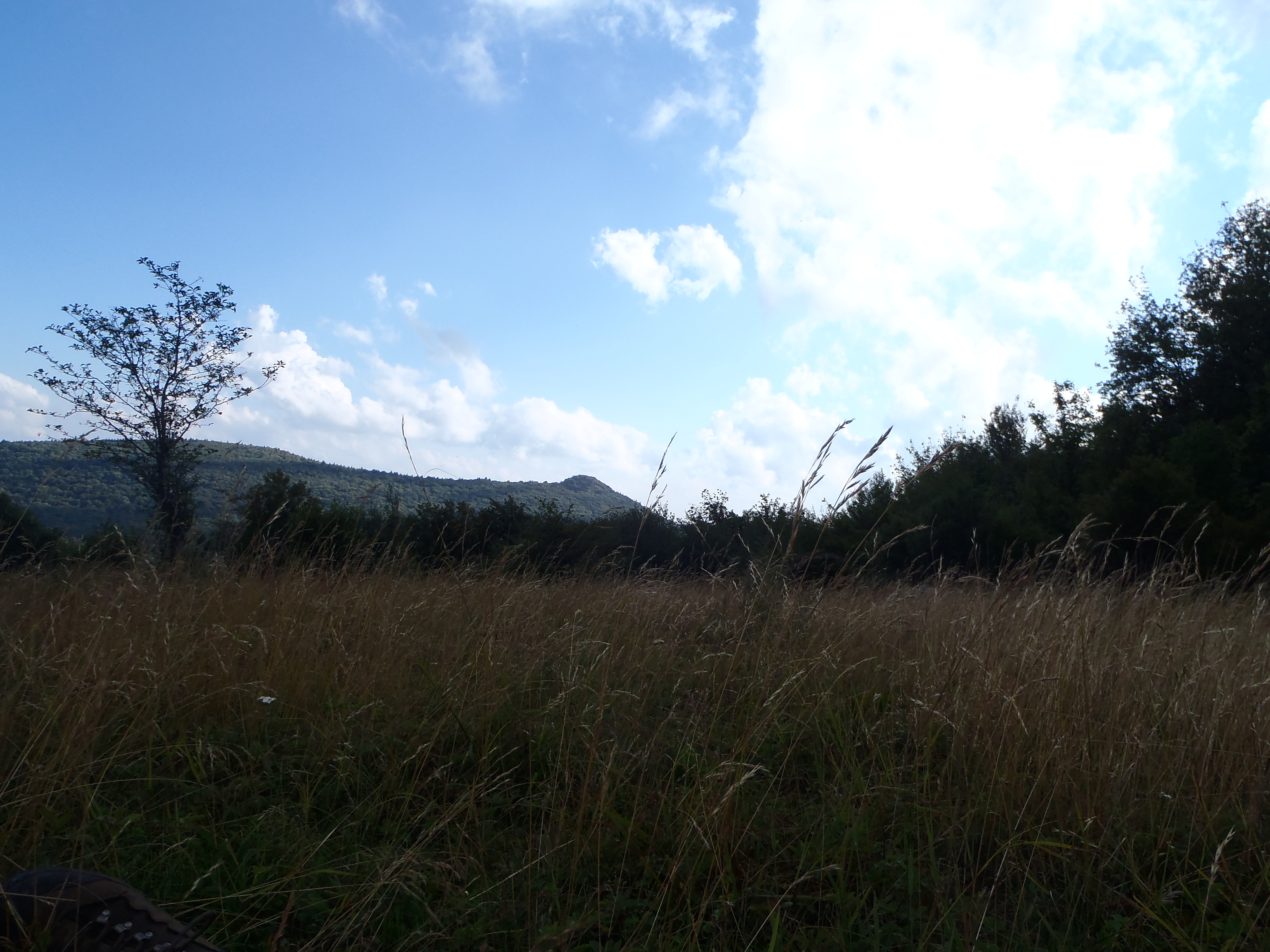
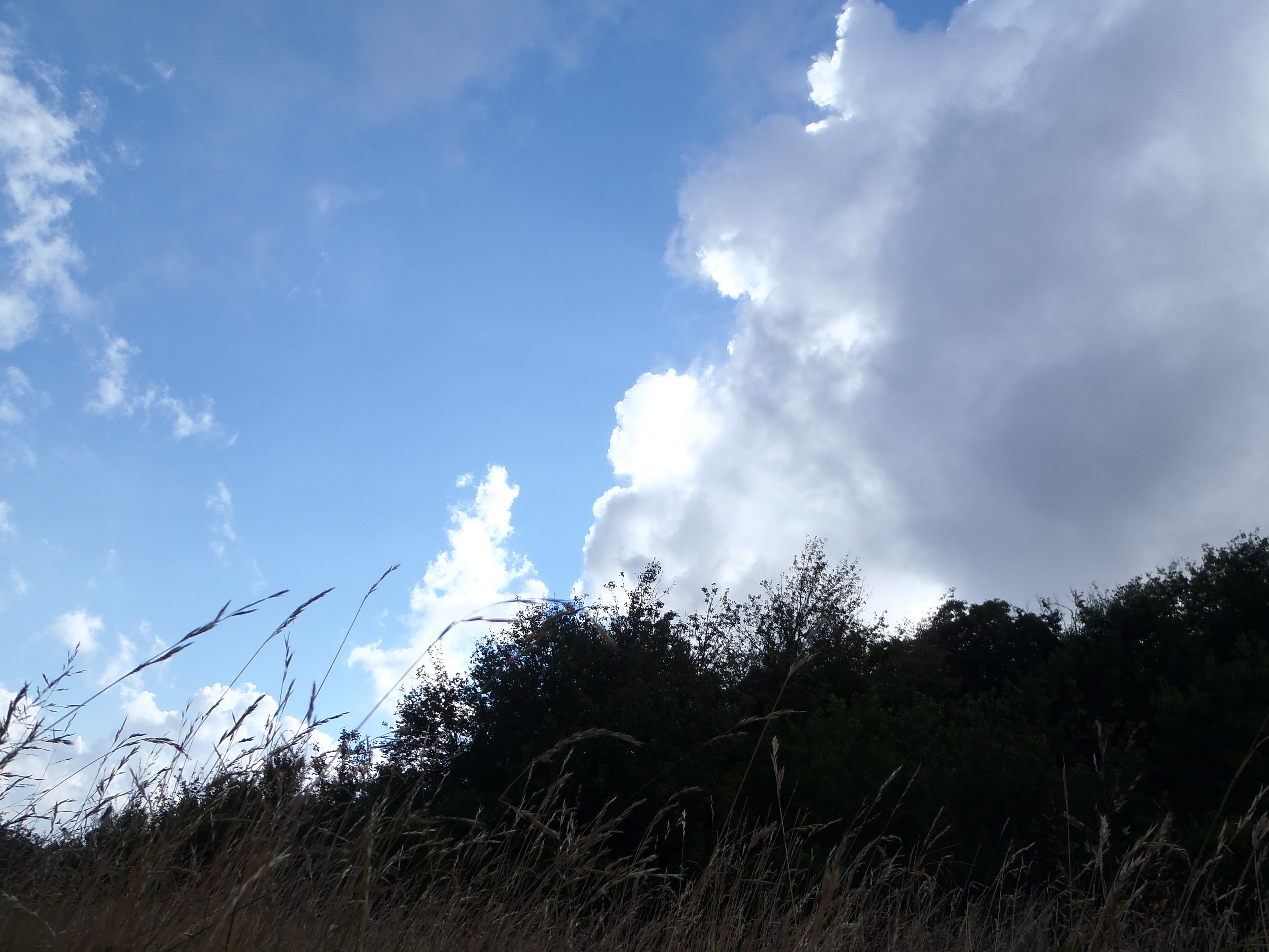
Appalachian trail. The beaten path curves south, and here the trail instantly changes moods. The trees open up, and you’re suddenly walking across open grassy meadows atop the mountains cap. There are many great places to set up camp. You are allowed to camp along any section along the AT, so take this opportunity if you’re ready to set up shop any relax the day away, or if you are looking to camp in the open. You’ll cross several open balds which offer great night sky views. Once you cross a bridge over a river,  you’re options change. Continue on if the weather is rough, you’ll be reentering the forest where you’ll find shade and protection from the elements, or if you simply aren’t ready to stop, push on. You’ll enjoy the cooling shadows of the tall hardwoods for over a mile. Here, we began to be harassed by thunder, and rolling black clouds, but I opted to push on anyway despite discovering several wonderful camp spots, and for me it paid off.
Next, you’ll find the Spur Trail. This signifies your last chance to set up camp, as there is no camping outside of the AT. This is where we camped. The slow, glowing sun ushered in cool night winds and the gentle gush of air around the mountain tops. We awoke the next morning with a kindly greeting sunrise shimmering across the dew soaked grass.

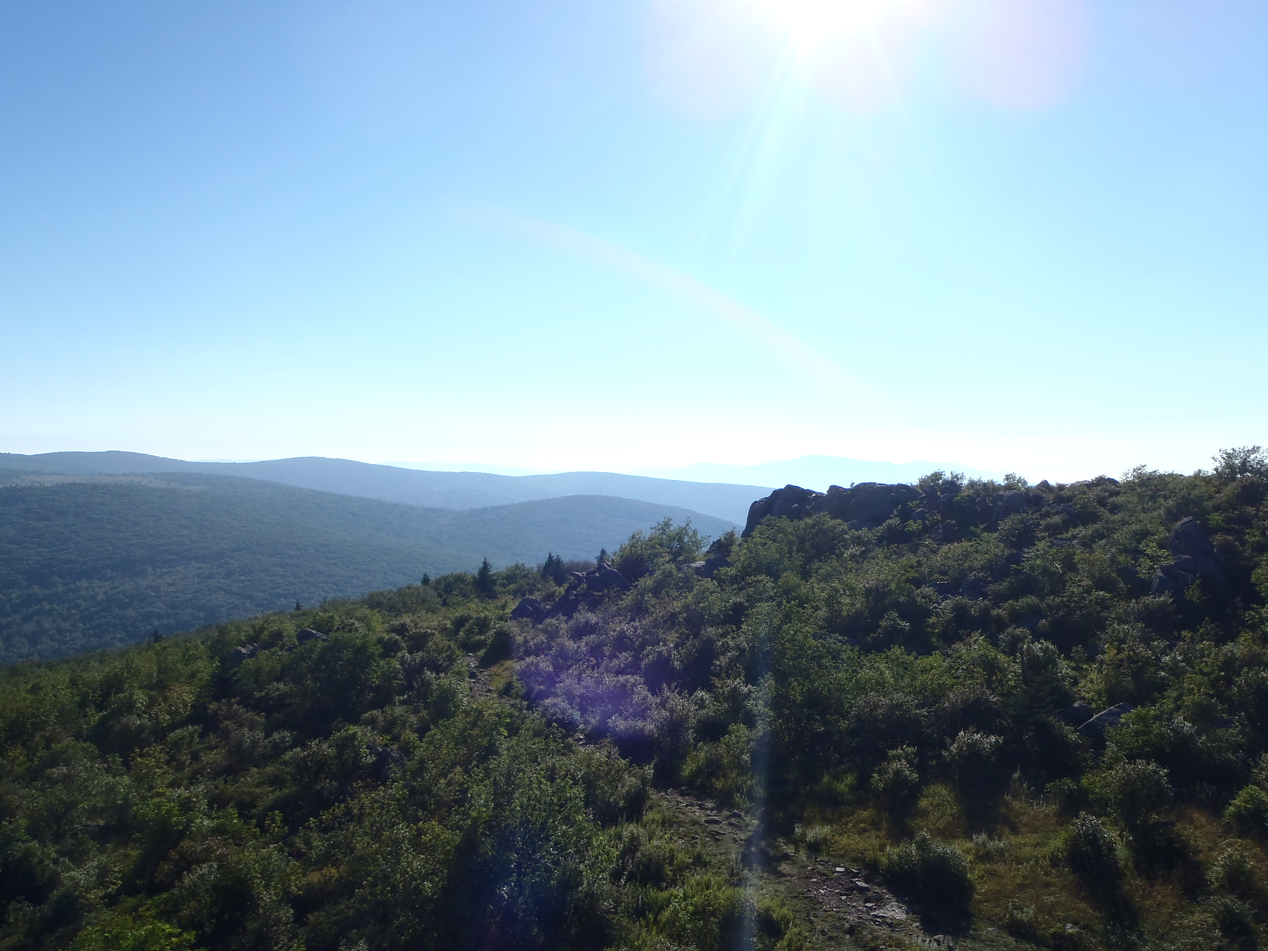
The spur trail signifies a change, you’ll feel like you’ve left Virginia, and somehow found your way into something very different. The trees regress, and leave behind open fields, blueberry bushes, and wide open vistas that wrap around the protruding stone peaks all around you. This is absolutely beautiful, and impossible to accurately describe. You’ll follow this south, which reconnects back to the Backpackers Campground.
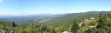
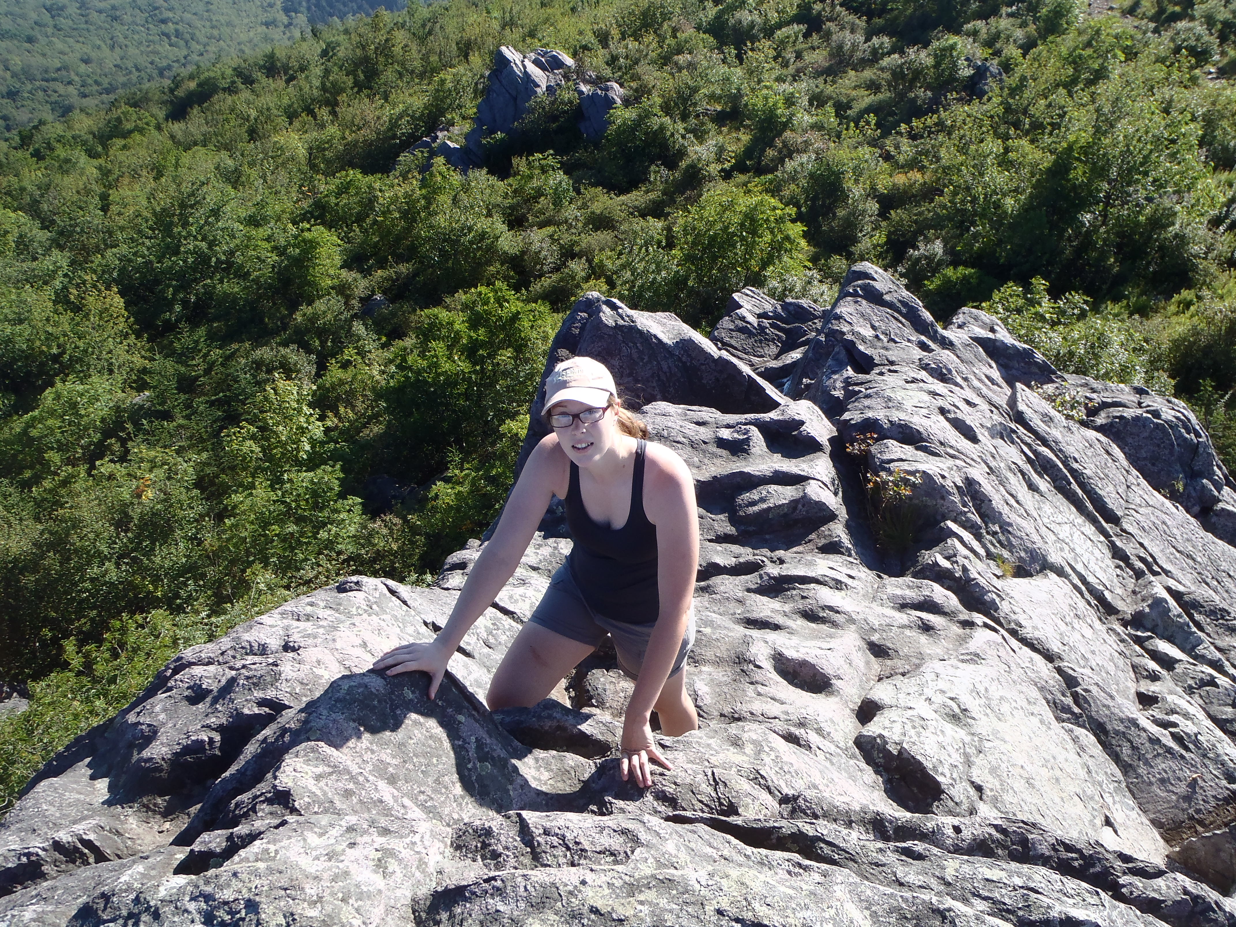
Still not done? If you’re feeling chipper, you can dump your pack at your car at the Backpackers campground and head west for about a half mile to the Big Pinnacle Trail on your left. I recommend taking your car, as there is parking there, and I’ve never enjoyed walking a road. The Big Pinnacle trail is a solid mile of climbing through rock, but beautiful woods and rock formations, and connects to the Twin Pinnacle Trail, which is absolutely stunning. You’ll find yourself standing High atop the entire park, with stunning 360 views. If you have it in you, I highly recommend pushing on and hitting this trial.
Alternative Route:
For less variety, but more open balds, take the spur trail and travel out along the Appalachian Trail towards Mount Rogers. 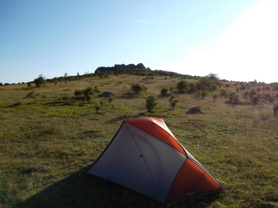 Vast rocky overlooks and scrambles await those who seek them. You can hit the peak of Mount Rogers, and double back in a single night. There isn’t a view at the summit, but the journey is gorgeous.
For a Double night trip:
Hit the original route, then buckle onto the AT on your second day towards mount rogers. Camp near the peak, and come back on your third day via the Spur Trail.
Overal, Grayson Highlands State Park offers amazing views, and a huge amount of variety. I’ll soon be returning to tackle more of the Appalachian Trail, and I’m counting every moment. This trip is Highly recommended.


Discover more from TreeLineBackpacker
Subscribe to get the latest posts sent to your email.

this is one of my favorite areas in the US!! Just LOVE it every time I visit! 🙂
Where do you park, and do you have to rent a camp site to be allowed to do this?
It’s been a while but there is a designated overnight parking lot as you enter the park. It’s just at the bottom of the AT spur trail.